

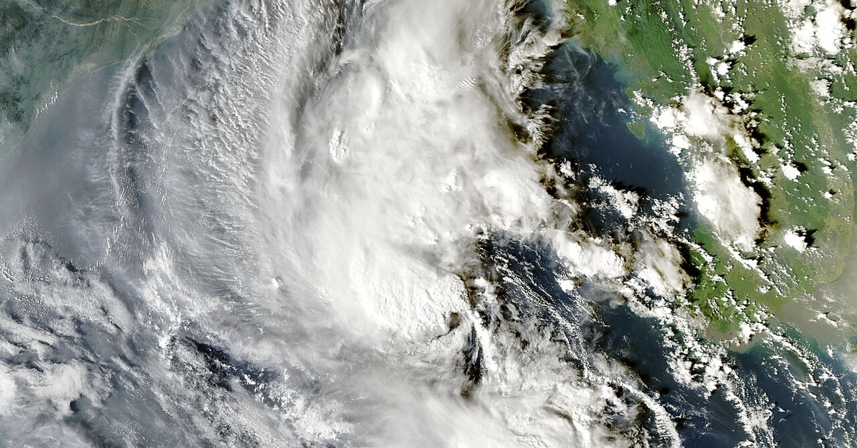
KATHMANDU — The warning is for three days: Oct. 29, 30 and 31. Nepal’s National Disaster Risk Reduction and Management Authority has asked everyone concerned to remain on high alert through that period. Behind the warning is Cyclone Arnab, gaining strength in the Bay of Bengal.
The India Meteorological Department calls Arnab — pronounced Ornab — a very severe cyclonic storm. It sat over the westcentral Bay of Bengal on Tuesday morning. The department fixed its center at 15.9°N and 84.8°E at 5:30 a.m. IST on Oct. 27.
It was 380 km south of Gopalpur, in Odisha. Over the previous six hours it had moved nearly westwards at 22 kmph, the department said. Visakhapatnam, in Andhra Pradesh, was its closest named reference point, 260 km northwest of the center.
It lay 300 km east-southeast of Kakinada. A west-northwestward move comes next, the department expects. It should last until Tuesday evening. Then the storm turns northwestwards.
The storm was 390 km east of Machilipatnam. It was 460 km east of Bapatla. Both towns are in Andhra Pradesh. Sri Vijaya Puram, in the Andaman Islands, had the storm 980 km west-northwest of it.
Landfall is very likely by the forenoon of Oct. 28. The likely crossing stretch runs between Bapatla and Visakhapatnam, close to Yanam, on the Andhra Pradesh and Yanam coasts. The storm will still be very severe at crossing. Its maximum sustained winds are 115 to 125 kmph. Gusts reach 140 kmph.
One more detail from the department: the Doppler Weather Radar at Visakhapatnam has the system under continuous surveillance.
In a notice dated Oct. 27, the Nepal authority said its warning rests on a special post-monsoon bulletin from Nepal’s Department of Meteorology.
Nepal will start to feel the storm on the night of Thursday, Oct. 29, according to the authority’s current analysis.
Koshi, Bagmati, Madhesh, Gandaki and Lumbini provinces are expected to take the worst of it on Friday and Saturday. Moderate rain is likely in many places in those provinces, with thunder, lightning and wind, and heavy rain in a few places.
Karnali and Sudurpashchim are not expected to escape it either. The notice says moderate rain, again with thunder, lightning and wind, is likely in some places there, and heavy rain is possible at one or two locations.
Higher up, the risk turns to snow. The authority warned of a high risk of heavy snowfall, snowstorms and avalanches in the high hill and Himalayan areas of the provinces named above.
Tourists should not travel to the high hills or the Himalayan region during this period, the notice said. Those already there should stay in a safe place throughout the period.
Road and air travel may be disrupted, and daily life with it. Take precautions, the authority said, and do not travel at all unless the trip is essential.
Nor should people stay in high-risk areas, the notice added, in particular along riverbanks that could flood.
Forecasts and early warnings will come from the authority, the Nepal Meteorological Department and other official agencies. The notice asked people to monitor them regularly and to comply with them.
Anyone who needs weather information can call 1155. For help in a disaster, the numbers are 1234 (NEOC/DEOC), 100 for Nepal Police, 1114 for the Armed Police Force, Nepal, and 1144 for the Tourist Police.
The notice was signed by Ram Bahadur K.C., an under secretary and the authority’s spokesperson.
Have something to promote?
Bring your business, services or event to our readers.