- Derecho likely today across the Northern Plains and Upper Midwest
- Winds over 75 mph, large hail, and tornadoes are possible
- Flash flooding risk expands into the Central Plains on Tuesday
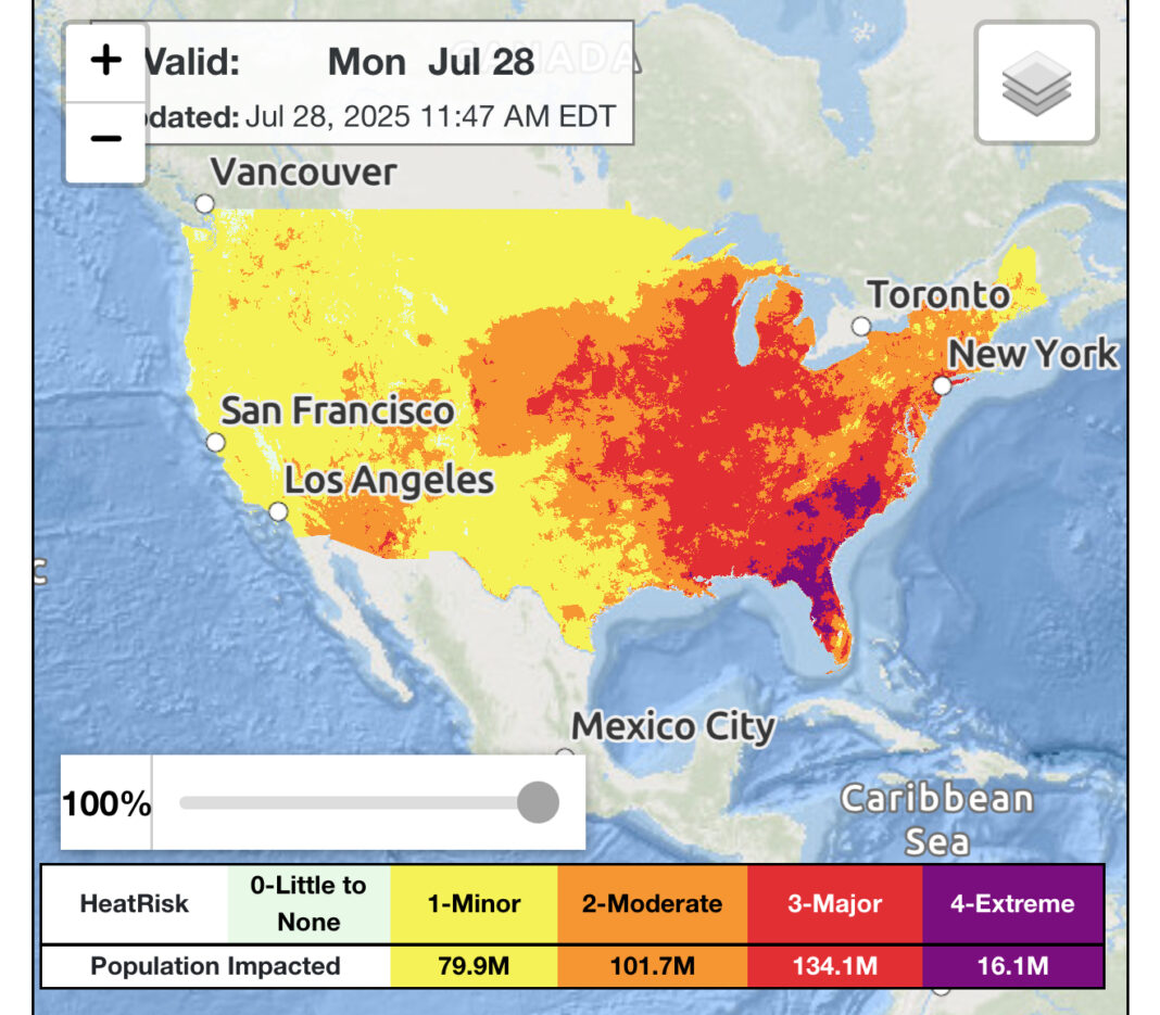
- Extreme heat and humidity to impact Southeast through midweek
- Heat index values may exceed 115°F in cities like Orlando and Charlotte
Severe Thunderstorms and Derecho Threat
According to the National Weather Prediction Center, a dangerous derecho event is expected to develop late Monday afternoon, July 28, over parts of eastern South Dakota before pushing into southern Minnesota and northern Iowa by evening.
The Storm Prediction Center has issued a Level 4 out of 5 moderate risk for severe weather in this region, with damaging wind gusts surpassing 75 mph likely. Embedded tornadoes and severe hail may also accompany the line of storms.
Flash Flooding Concerns Shift Southward
Beyond Monday’s storms, the risk of excessive rainfall and flash flooding is expected to shift farther south on Tuesday. Forecasters anticipate thunderstorms from southeastern Montana through western South Dakota, Nebraska, and western Iowa to bring high rainfall rates.
These storms, expected during the overnight hours into early Wednesday, may impact urban areas and agricultural zones with already saturated ground, increasing the risk for runoff and localized flooding.
Relentless Heat Wave in the Southeast
In the Southeast, an ongoing heat wave is creating extremely dangerous conditions, especially in major metro areas such as Raleigh, Charlotte, and Orlando. The heat index—also known as the “feels like” temperature—is expected to exceed 110 to 115°F through Wednesday.
Over 18 million people are currently under an Extreme HeatRisk alert, with the highest concern centered on vulnerable populations without access to cooling or hydration. Public health officials are urging residents to stay indoors, use fans or air conditioning, and check on neighbors.
Looking Ahead
The pattern of widespread severe weather in the central U.S. and relentless heat in the Southeast is expected to persist into midweek. Residents in high-risk zones are encouraged to follow updates from local authorities and the National Weather Service for real-time alerts.
Understanding Fairfax County’s Heat Emergency Plan
July 28 Morning News Highlights
Follow Virginia Times for regular news updates. Stay informed with the latest headlines, breaking stories, and in-depth reporting from around the world.
A global media for the latest news, entertainment, music fashion, and more.


